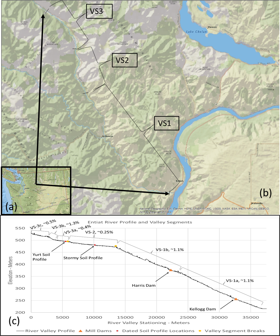
A maturing body of evidence suggests that anthropogenic impacts on river-wetland corridors may be greater and more widespread than previously recognized. We applied the Geomorphic Grade Line (GGL) method to define pre-Anthropocene valley surfaces within segments of the 42-kilometer Entiat River Valley (ERV) of the North Cascade Mountains, USA. We developed GGL-relative elevation models (GGL-REMs) by subtracting, from high-resolution digital elevation data, a detrending surface based on relic fluvial features of the valley floor. We validated the GGL-REMs using surficial geologic maps, C 14-dated soil profiles, and the identifiable remnants of historic dams. We interpreted these data in the context of settlement land use practices including channelization, large wood removal, and beaver ( Castor canadensis) trapping. Our analysis indicates that since the early 20 th century, the river has incised more than two meters in many areas. This triggered a rapid state and process change, wherein unconfined and partially-confined valleys transitioned from net deposition to erosion and transport environments. The distribution of river types shifted from ecologically rich river-wetland corridors towards simpler, single-threaded channels common in confined valleys. The effects of this state change on salmon productivity were profound. Results from the Entiat and other locales indicate that GGL-REMs can be used to help define the fluvial process-form domains, including the vertical dimension needed to guide valley floor restoration. These tools can be used to envisage pre-degradation riverscapes, especially when used in concert with other datasets. Once the pre-Anthropogenic conditions of rivers like Entiatqua have been recognized, the case for restoring lost river-wetland corridors to unlock their ecological potential becomes compelling.