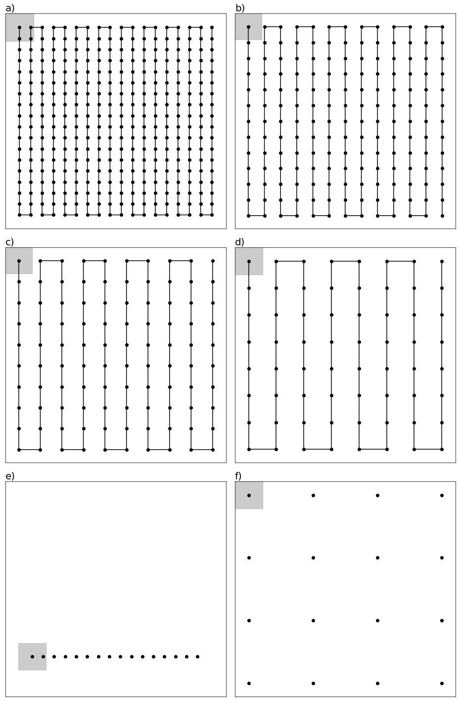
The use of remote sensing to monitor animal populations has greatly expanded during the last decade. Drones (i.e. Unoccupied Aircraft Systems or UAS) provide a cost- and time-efficient remote sensing option to survey animals in various landscapes and sampling conditions. However, drone-based surveys may also introduce counting errors, especially when monitoring mobile animals. Using an agent-based model simulation approach, we evaluated the error associated with counting a single animal across various drone flight patterns under three animal movement strategies (random, directional persistence, and biased towards a resource) among five animal speeds (2, 4, 6, 8, 10 m/s). Flight patterns represented increasing spatial independence (ranging from lawnmower pattern with image overlap to systematic point counts). Simulation results indicated that flight pattern was the most important variable influencing count accuracy, followed by the type of animal movement pattern, and then animal speed. A lawnmower pattern with 0% overlap produced the most accurate count of a solitary, moving animal on a landscape (average count of 1.1 ± 0.6) regardless of the animal’s movement pattern and speed. Image overlap flight patterns were more likely to result in multiple counts even when accounting for mosaicking. Based on our simulations, we recommend using a lawnmower pattern with 0% image overlap to minimize error and augment drone efficacy for animal surveys. Our work highlights the importance of understanding interactions between animal movements and drone survey design on count accuracy to inform the development of broad applications among diverse species and ecosystems.